| |
Search for the Lost Tomb of Genghis Khan |
|
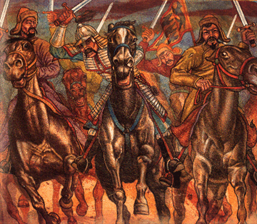 |
Genghis Khan was perhaps the greatest and most ruthless conqueror the world has ever know. More than three million people may have died during the bloody creation of his empire. During his twenty year reign Khan subdued the Russian princes; his army conquered Persia, Asia Minor, Korea, South-East India, Indonesia, and China.
Where is Khan’s Tomb?
Many years before his death, the fearsome Mongol conqueror, after the custom of his people, chose his own grave site. Legends state that Khan chose the shelter of a lone tree near the base of Mount Burkhan Khaldun in Mongolia’s wild Khingan mountain range. So, somewhere deep in the mountains, Khan’s men dug an elaborate Tomb and Genghis Khan was laid to rest in an ornate coffin.
Into the grave with him went the royal treasury – a massive hoard of gems and precious metals — the spoils of war collected by Khan from all the lands he’d conquered in his twenty year reign. Some say the treasure included the crowns of each of the seventy-eight rulers Khan had subjugated, including those of Russia, Persia, and India.
|
At the age of 65, during a campaign against the Chinese, the great Khan suffered a fatal fall from his horse, and in August of 1227 the mourning Mongol army abandoned the conflict to take their leader home.
After many months of pomp and ceremony, the body of the fallen ruler was loaded onto a giant oxcart and began its long journey towards the Khan’s final resting place. Surrounding the cart was a funeral procession 2,500 strong accompanied by a mounted bodyguard of 400 soldiers.
The Cover-up
Legend has it, that Genghis Khan’s soldiers killed every person encountered by the funeral procession on its journey into the mountains. And after Khan’s body was intured, the soldiers turned their attention to the slaves who dug the tomb, slaughtering all 2,500 of them. When the soldiers returned to Karakorum, Genghis Khan’s capital, they in turn were killed by other soldiers so they couldn’t reveal the location of Khan’s tomb.
To make the Tomb even harder to find, local legends say that a river was diverted over Khan’s grave, completely submerging it. Other tales state that his grave was stampeded over by horses to erase signs of digging, then trees were planted on top of it. The forest men of the Uriangut clan were appointed to nurture the saplings covering the grave, and eventually the burial site was swallowed in an impenetrable forest.
Whatever the truth may be, it seems as if Genghis Khan’s plan to protect his final resting place was effective. Despite the efforts of many well financed archaeologists and treasure hunters, to this day not one scrap of treasure has been recovered.
If someone does someday succeed in locating the tomb of the great conqueror the discovery could make unearthing King Tutankhamen’s tomb in Egypt seem minor by comparison.
Location, Location, Location
At Genghis Khan’s death, his empire stretched from the Pacific Ocean to the Aral Sea, leaving an incalculable number of possible locations for his tomb. There are many theories as to where Genghis Khan’s final resting place might be – some theories put the tomb within Mongolia’s rugged mountains, others say he could have been buried in China, where he died during his final campaign.
One of the oldest references to Khan’s burial location is the 15th century account of a French Jesuit which states that Genghis Khan may have selected as his final resting place, the confluence of the Kherlen and Bruchi rivers near the Burkhan Khaldun mountain.
The highest peak of the Khentii Range in north-central Mongolia is 9,173-foot Asralt Khairkhan, also known as the Burkhan Khaldun of the Kerait people.
The Kherlen river is still known today – but attempts to locate the “Bruchi” river, have drawn a blank – the river is unknown to modern day cartographers. Unfortunately this makes it impossible to pinpoint the exact location for the tomb specified in the ancient texts.
Amateur archeologist, Maury Kravitz, who’s been obsessed with Khan’s tomb for forty years, did discover a toponym “Baruun Bruch” (”West Bruch”) in the area roughly 100 km east of Burkhan Khaldun (48° N 110° E). In 2004 he conducted excavations there to no avail.
So, for now, the location of Khan’s tomb and the vast treasure it may contain, remains one of archaeology’s greatest unsolved mysteries.
It’s one of the few great archaeological mysteries of the world, and now a bunch of gadget-wielding geeks are going to try and solve it.
The tomb of Genghis Khan, founder of the Mongol empire and one of the world’s greatest and most ruthless emperors, has remained hidden for nearly eight centuries. According to legend, Khan died in 1227 near the Liupan mountains of China and is thought to be buried in the northeastern region of what is currently Mongolia.
Now a group of researchers led by University of California San Diego’s Center of Interdisciplinary Science for Art, Architecture and Archaeology, with funding from National Geographic, have embarked on a quest to find this ancient grave. Their secret weapon: an array of technological gizmos ranging from unmanned aerial vehicles to sophisticated satellites and 3-D displays.
“This is a first of its kind,” says Mike Henning, a researcher at UCSD, “a large scale expeditionary-type project that promises to open up new doors for technology.”
Hennig and the entire expeditionary team left for Mongolia earlier in July and will be there until the end of the month. They will do most of their work in an 11-square mile region in Mongolia flying two UAVs, directing satellite imagery and collecting data that will be processed at home later.
GeoEye
Satellite imagery will play a key role in the search for the tomb. GeoEye, a company that offers geospatial data from high-resolution cameras on board its orbiting satellites, will work with the researchers. Based on their instructions, GeoEye will point its Ikonos satellite at regions where Khan’s grave is likely to be. The resultant imagery will be downloaded from Ikonos via a microwave downlink and processed at GeoEye’s office in Denver.
“Kids in MIT are using our satellite imagery to study urban planning in Mexico City,” says Matt O’Connell, CEO of Geo-Eye. “Georgia Tech is working to track gorilla habitats and now we hope our satellite can help find the tomb of Genghis Khan.”
GeoEye’s Ikonos satellite launched about 10 years ago. Ikonos orbits the earth every 90 minutes and can create color images with a resolution of up to 1 meter. The satellite is 423 miles up in the sky.
“With the Ikonos images we can see something the size of 32 inches on the ground,” says O’Connell.
Currently, GeoEye has three satellites in orbit: the Ikonos, GeoEye1 and OrbView 2. GeoEye’s customers include governments and businesses. For instance, pictures from GeoEye1 satellite are used in Google Maps and Google Earth.
In tests earlier, the average GeoEye image given to the UCSD project members covered about 6.8 square miles and was about 300 MB in size.
“They can apply data mining algorithms to our imagery and scan for anomalies such as unnatural geometric formations,” says O’Connell. “It’s the first step in their quest.”
UAVs
Researchers in Mongolia will also be counting on unmanned aerial vehicles to get pictures of the zones that they believe could hold the grave.
“We are looking at a GPS-guided aircraft that can do live streaming and digital still images at the same time,” says Gene Robinson, CEO of RP Flight Systems, whose two UAVs will be deployed for the task. “Its capabilities are pretty impressive.” The Texas-based company has been designing and selling UAVs used in search, rescue and recovery missions for about seven years.
Each UAV has a 4-foot wing span and weighs around 4 pounds, including all the equipment. The UAVs are made with a composite based on polystyrene and fiber glass and the hull is coated with Kevlar. The UAVs, powered by a lithium-polymer battery, will fly at a typical altitude of between 400 and 600 feet with each flight lasting about an hour.
The UAVs are standard off-the-shelf systems called the Spectra Flying Wing. The only customization is a modified camera that can do both infrared and full color images, says Robinson. Each of the fully autonomous UAVs with sensors costs $15,000.
The biggest draw of RP’s UAVs is that they are unclassified, allowing the images from them to be easily accessed by all. Aerial vehicles from NASA or most governmental agencies are classified as ‘dual-use technology,’ marking them suitable for military and civilian use. But it also limits how the technology or information derived from it can be used. “If a dual-use airplane takes pictures, those are considered classified and have to be declassified before anyone can take a look at it,” says Robinson, a process that could sometime take days. “With us the data is available for immediate distribution.”
Downloading the images from the UAV to a computer is as simple as unplugging the on-board SD card and hooking it up to a PC. “The image analysis involves looking at patterns, colors, shapes that don’t belong in nature,” says Robinson.
Creating a computational algorithm
Earlier this year, Luke Barrington, a doctoral student at UCSD, released a Facebook application called ‘Herd It‘ that allows users to discover music, much like Pandora or Last.fm. The app also lets listeners play word association games based on the music they hear and identify the key themes in the song.
The idea was to create a machine learning algorithm that could analyze and classify music. Think of it as similar to what Pandora does—the difference being that the Herd It uses people to train the algorithm instead of having people always classify the music.
“One of the key components in learning systems is that you need to train them with a couple of strong examples,” says Barrington. “So with Herd It, I developed this game that would collect consensus about what genre a song belongs to.”
The crowdsourcing collects reliable, accurate examples of words people use to describe music, which can be used as training data for a machine learning system. The system can then listen and analyze songs and describe them the same way that people do.
Turns out that’s exactly the kind of approach that the Genghis Khan expedition needs, which is why Barrington is turning his talents from pop music to image analysis. With hundreds of satellite images to sift through, the team hopes to use people to find examples of unnatural features.
“One of the challenges with the satellite imagery is that we don’t know what exactly we are looking for,” says Barrington. “We need human input to find examples of anomalies and unnatural patterns that can be used to train an algorithm.”
It’s also a way to give the larger community a chance to play Indiana Jones. “We want to help people become a bit of explorers themselves,” says Barrington.
Read more at http://www.wired.com/gadgetlab/2009/07/genghis-khan/
Liked it ? Want to share it ? Social Bookmarking
Discuss article |
Article Link
|
More unsolved mysteries on Unexplained Mysteries
|